
Citation: UNSPECIFIED.
![[thumbnail of RiverRoad1.jpg]](http://researcharchive.wintec.ac.nz/567/15/RiverRoad1.jpg)

RiverRoad1.jpg
Download (111kB) | Preview
![[thumbnail of RiverRoad2.jpg]](http://researcharchive.wintec.ac.nz/567/16/RiverRoad2.jpg)
RiverRoad2.jpg
Download (142kB) | Preview
![[thumbnail of RiverRoad3.jpg]](http://researcharchive.wintec.ac.nz/567/17/RiverRoad3.jpg)

RiverRoad3.jpg
Download (115kB) | Preview
![[thumbnail of RiverRoad4.jpg]](http://researcharchive.wintec.ac.nz/567/18/RiverRoad4.jpg)

RiverRoad4.jpg
Download (180kB) | Preview
![[thumbnail of RiverRoad5.jpg]](http://researcharchive.wintec.ac.nz/567/19/RiverRoad5.jpg)
RiverRoad5.jpg
Download (118kB) | Preview
![[thumbnail of RiverRoad6.jpg]](http://researcharchive.wintec.ac.nz/567/20/RiverRoad6.jpg)
RiverRoad6.jpg
Download (121kB) | Preview
Abstract
Objectives:
• Investigate and extend the narrative potential of photographic and digital media.
• Produce media outcomes that activate dialogue on ecological issues.
Overview:
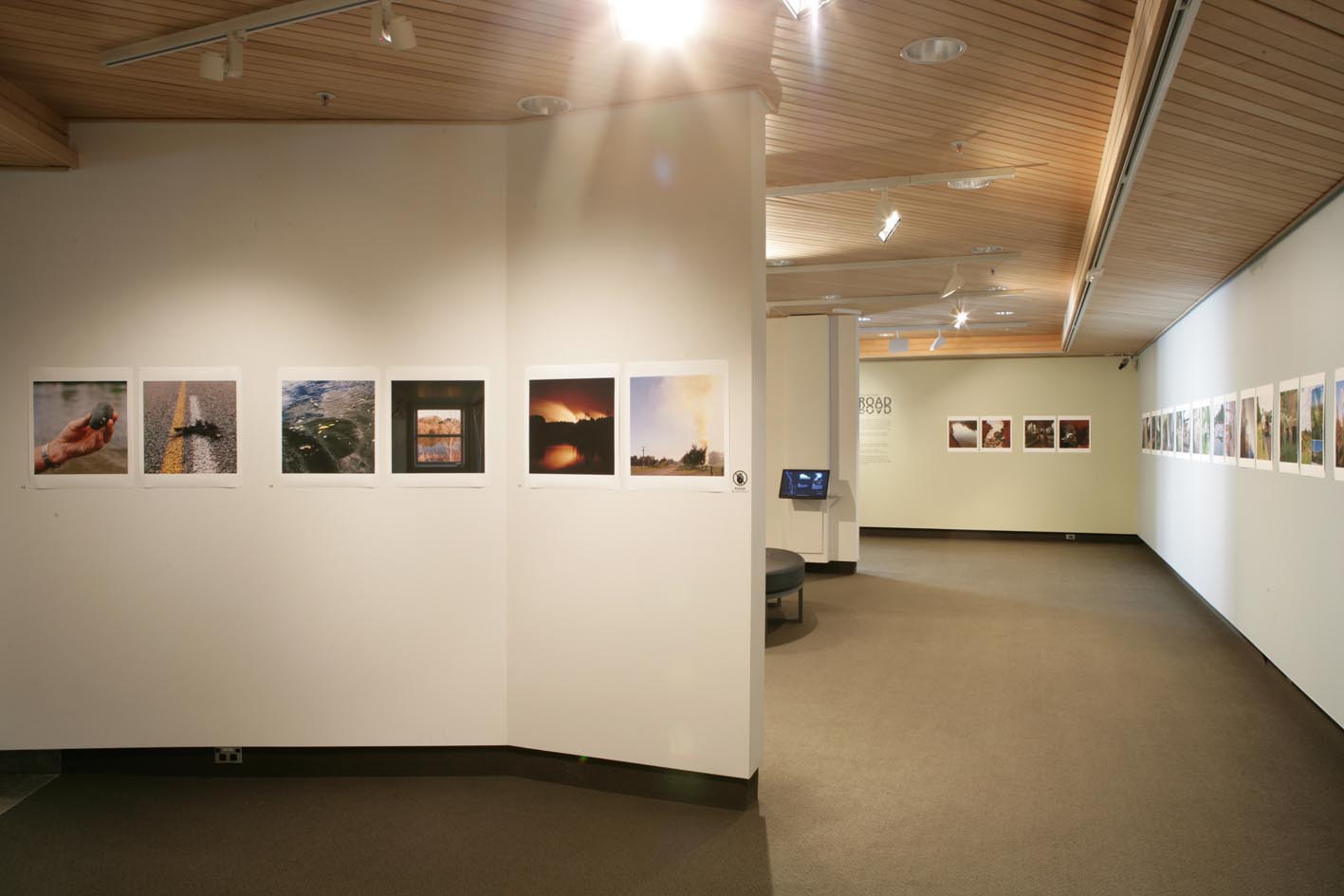
River / Road is a documentary project that visually investigates the ecology of a specific region, i.e. a 20km tract of land and river connecting Hamilton and Ngaruawahia. The two centres are connected by River Road, an artery spanning a great diversity of urban and rural spaces; suburbs, new housing developments, farming, a land fill site and Turangawaewae Marae. The Waikato, a parallel artery, also offers a range of sites and activities; wildlife, recreation, industrial discharges. This tract of land and river offers a suitably diverse but discrete area for fieldwork.
The research project is structured in three distinct phases:
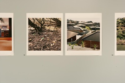
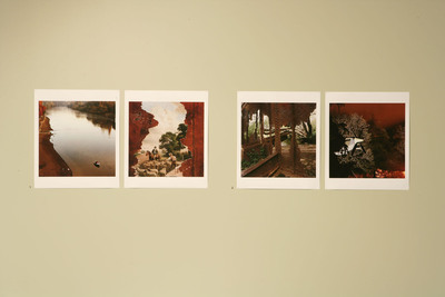
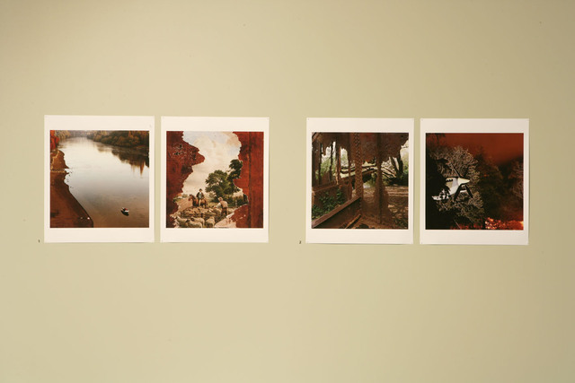
• Stage One (2007-2008) involves background research and fieldwork, i.e. observational photography. During this stage a ‘topographical’ methodology was developed and employed. A mapping methodology anchored the photographic component around a series of nodes plotted along the river and road arteries, at approximately 700metre intervals from start to finish. This resulted in 29 geographic nodes for photographic investigation, with each node yielding one photograph from the river and one photograph from the road. This pseudo-scientific ‘transect’ sampling technique was modeled on conventional biological field surveys. The methodology is also rooted in the tradition of topographic documentary surveys.
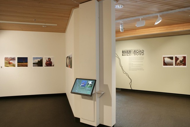
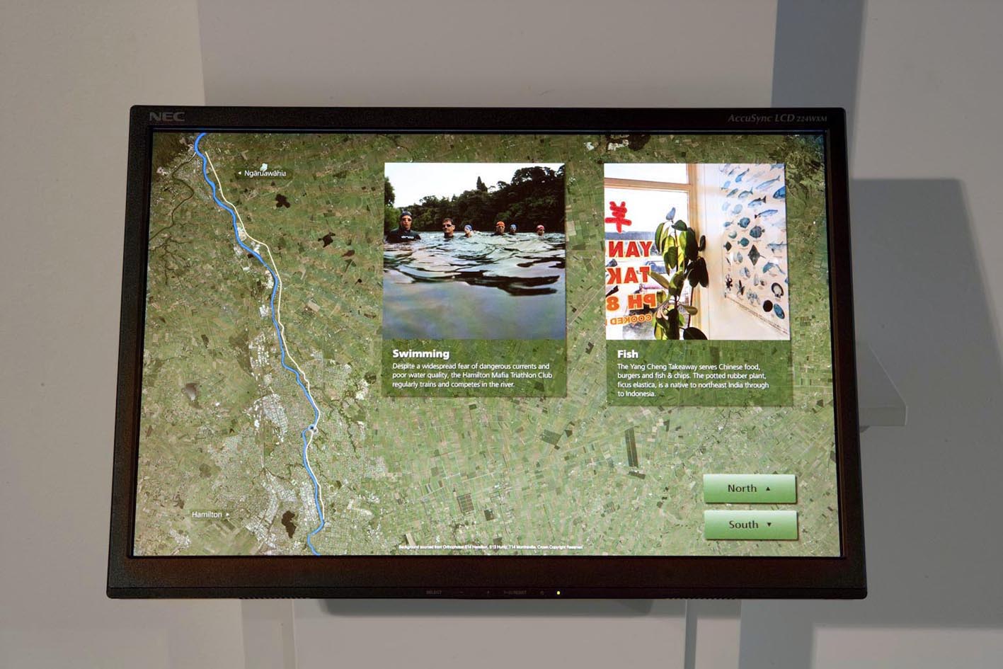
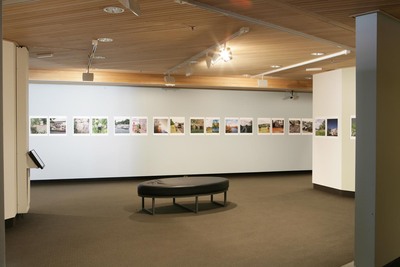
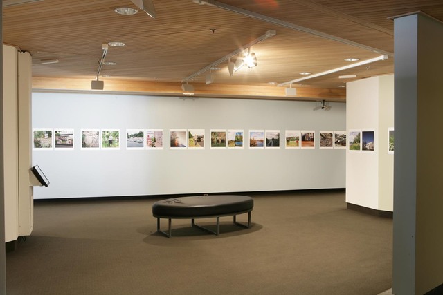
• Stage Two (2008-2009) involved a rigorous testing of the narrative potential of these photographs through the development and application of various editing and design strategies. Images were assessed for aesthetic value and content value. The major outcome was an exhibition of 58 prints, including wall maps and a digital interactive touchscreen computer at the Waikato Museum. Digital prints were pinned to the wall in sequence, without captions. Simon Nicholls was commissioned as a research assistant to design a touchscreen interactive computer display; this orientated viewers by locating photographs on a satellite map, offering written text to identify and discuss content.
• Stage Three (2010). A collaborative research project (photographer, designer, writer) will see the production of a manuscript for publication.
Project outcomes are designed to activate dialogues on contestable issues such as kaitiakitanga, urban planning values, industrial development, ecological restoration and environmental values.
| Item Type: | Contribution to a Show/Exhibition |
|---|---|
| Uncontrolled Keywords: | photography, digital media, ecology, topography, documentary, narrative, |
| Subjects: | G Geography. Anthropology. Recreation > G Geography (General) T Technology > TR Photography |
| Divisions: | Schools > School of Media Arts |
| Depositing User: | David Cook |
| Date Deposited: | 25 Jan 2010 21:09 |
| Last Modified: | 21 Jul 2023 02:22 |
| URI: | http://researcharchive.wintec.ac.nz/id/eprint/567 |
Actions (login required)

- View Item