
Citation: UNSPECIFIED.
![[thumbnail of IMG_5250.JPG]](http://researcharchive.wintec.ac.nz/3002/1/IMG_5250.JPG)
IMG_5250.JPG
Download (3MB) | Preview
![[thumbnail of IMG_5362.JPG]](http://researcharchive.wintec.ac.nz/3002/2/IMG_5362.JPG)
IMG_5362.JPG
Download (1MB) | Preview
![[thumbnail of IMG_5346.JPG]](http://researcharchive.wintec.ac.nz/3002/3/IMG_5346.JPG)

IMG_5346.JPG
Download (1MB) | Preview
![[thumbnail of IMG_5341.JPG]](http://researcharchive.wintec.ac.nz/3002/4/IMG_5341.JPG)

IMG_5341.JPG
Download (1MB) | Preview
![[thumbnail of IMG_5351.JPG]](http://researcharchive.wintec.ac.nz/3002/5/IMG_5351.JPG)

IMG_5351.JPG
Download (1MB) | Preview
![[thumbnail of IMG_5356.JPG]](http://researcharchive.wintec.ac.nz/3002/6/IMG_5356.JPG)

IMG_5356.JPG
Download (1MB) | Preview
Abstract
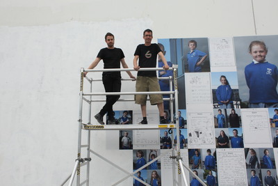
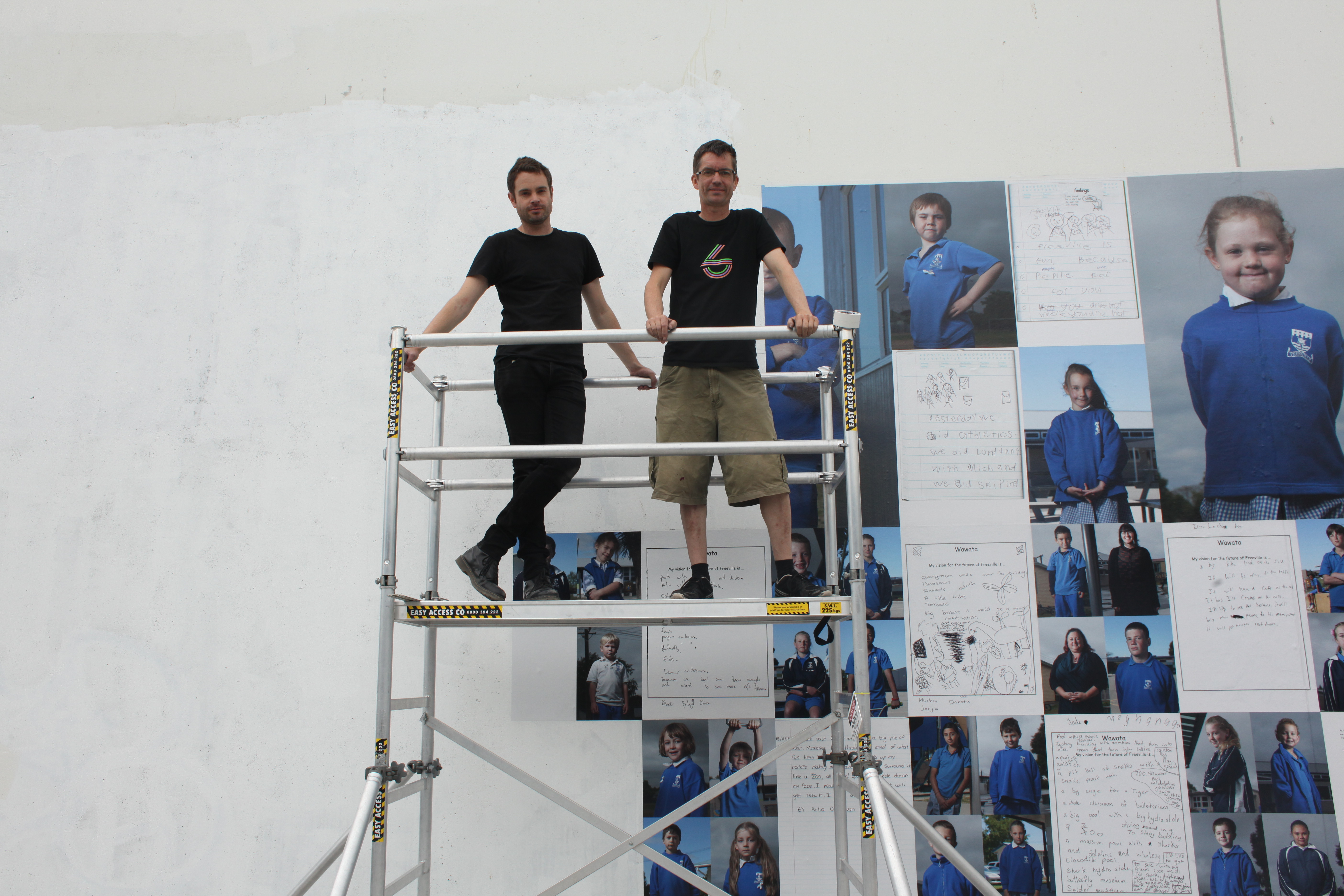
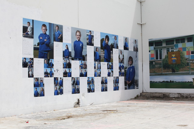
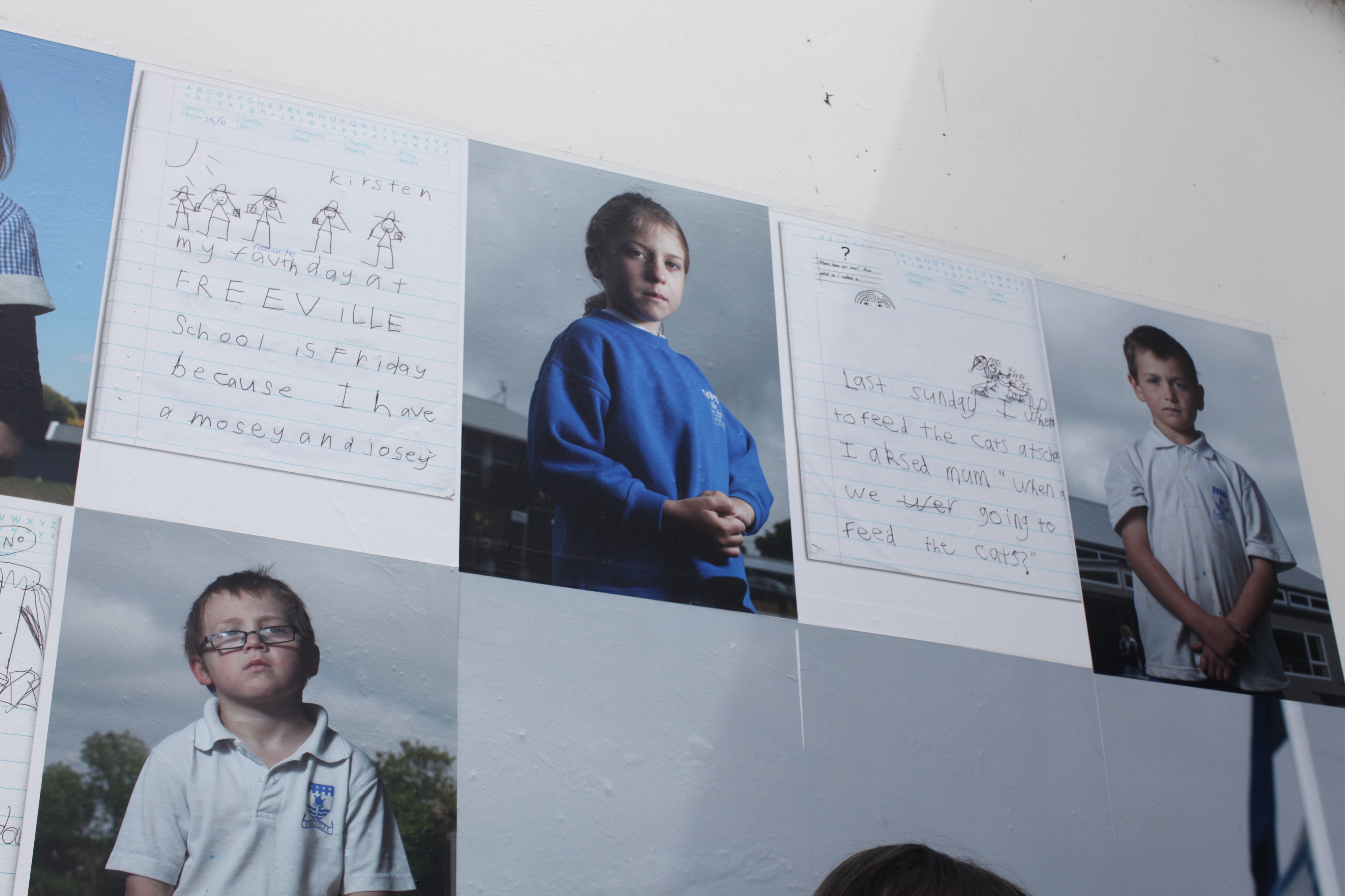
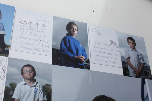
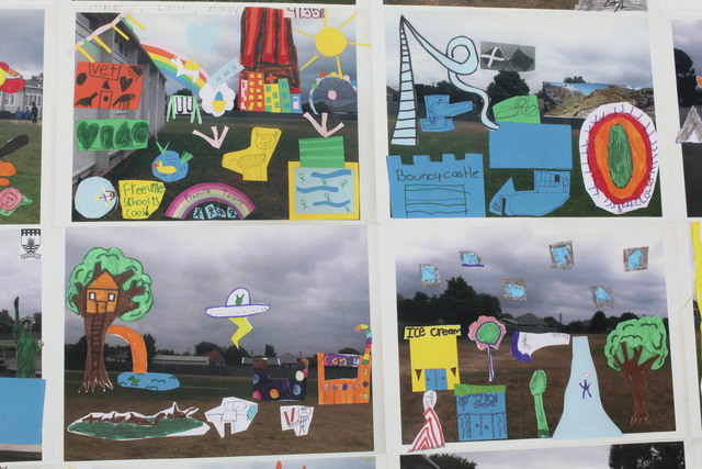
The Freeville Project is a photography based work made in collaboration with students and staff of Freeville Primary School in New Brighton, Christchurch, New Zealand.
The project is facilitated by David Cook (Wintec) and Tim Veling (University of Canterbury), and is incorporated in TEZA: the Transitional Economic Zone of Aotearoa, Christchurch, November 2013. (http://teza.org.nz/)
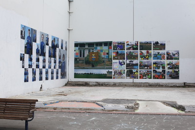
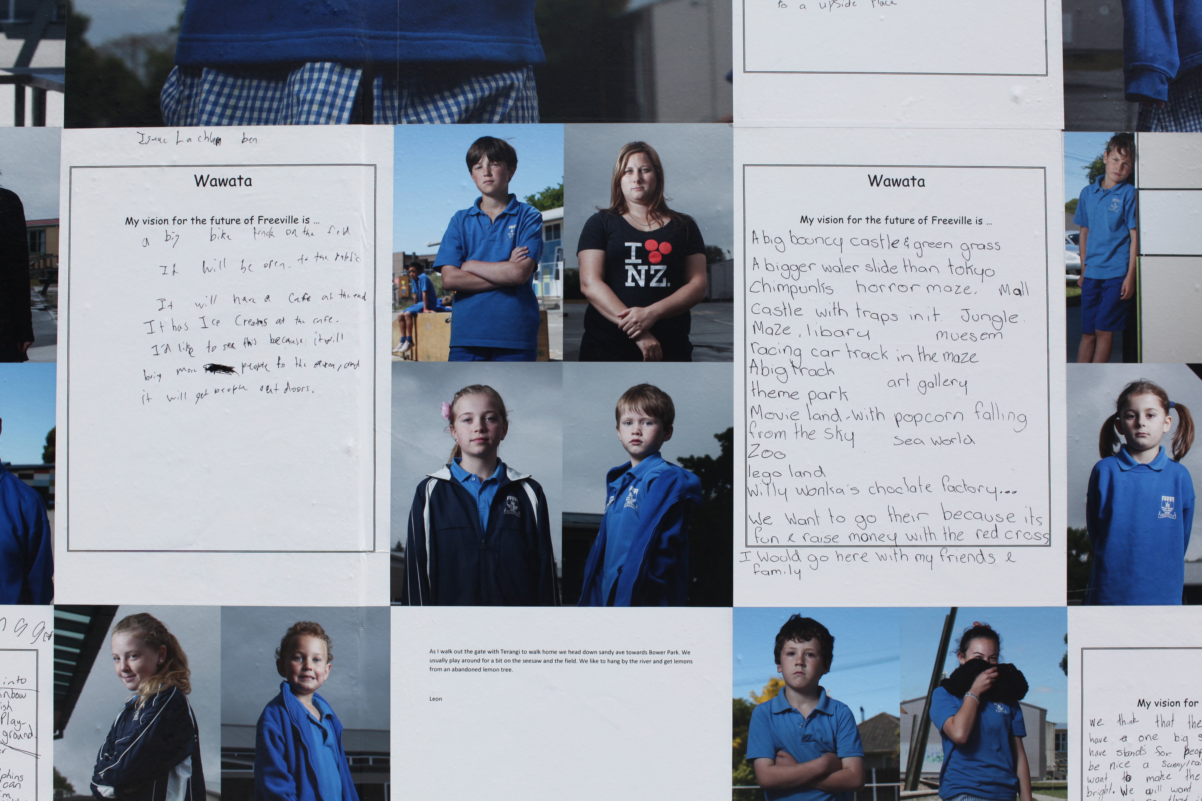
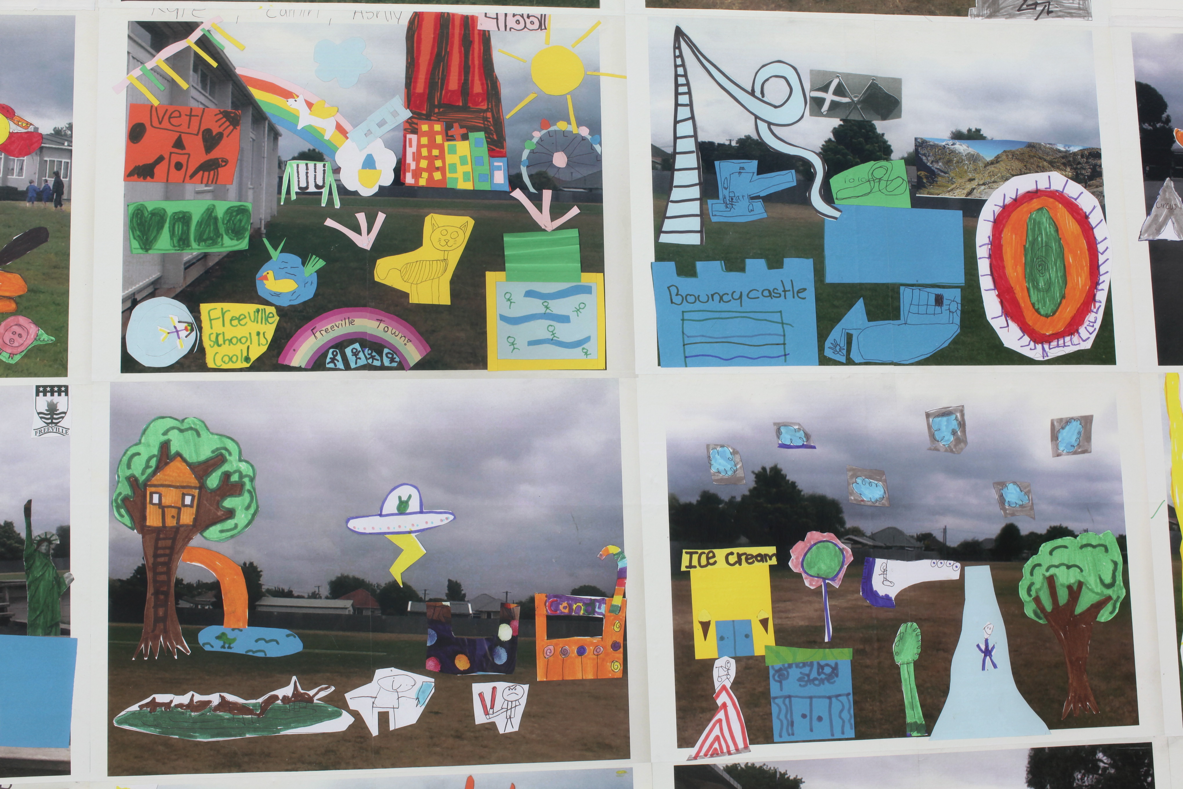
The project is the result of an intensive workshop with 60 students; discussing ideas of community and future vision for the school environment. Children wrote stories and created visual proposals for future developments.
David Cook and Tim Veling collaborated with teachers in facilitating this process, and also created a series of photographic portraits and landscapes. The finished body of work was exhibited as billboard-sized prints in the local New Brighton shopping mall, as part of the TEZA festival
Prior to the February 2011 earthquake, Freeville School commissioned the ‘Freeville School Landscape Concept Draft Plan’ (Rough & Milne landscape architects). This plan incorporated a wildflower bed, native trees, native shrubs and children’s artwork. With a clear agenda to educate and engage the community in the school’s surrounding ecological landscape, this plan could never have foreseen the dramatic events that followed its conception. As a result of the 2010 and 2011 earthquakes, the plan has gone unrealised.
On February the 22nd 2011, New Brighton’s landscape changed forever and the community’s understanding of the complex relationships between the natural, built and social environments was suddenly tested.
In 2013, the Ministry of Education announced that Freeville School is to merge with North New Brighton and Central New Brighton Schools. In 2015, the three schools will merge and operate between the Freeville and North New Brighton sites. In 2016, the Freeville site will be abandoned and operate solely from the North New Brighton site. Freeville School buildings and facilities, situated on land sold to the Ministry of Education by the Free family for the purpose of building an education facility, are scheduled to be demolished soon after.
This is to say that Freeville School is situated on what is now highly contestable land. The built environment that constitutes the school will disappear, but the future for the land itself is uncertain. It is especially ambiguous if allowance will be made for the school’s surrounding community to contribute ideas to inform the redevelopment. This project aims within the current ambiguous space to collaborate with remaining students and staff of Freeville School and help them re-imagine and articulate their own vision for the land’s future.
The final body of work will be kept within Place in Time’s digital archive at the University of Canterbury in Christchurch, New Zealand
| Item Type: | Contribution to a Show/Exhibition |
|---|---|
| Uncontrolled Keywords: | Photography, documentary, participatory media, Canterbury earthquakes, school children |
| Subjects: | L Education > L Education (General) N Fine Arts > N Visual arts (General) For photography, see TR T Technology > TR Photography |
| Divisions: | Schools > School of Media Arts |
| Depositing User: | David Cook |
| Date Deposited: | 03 Feb 2014 03:38 |
| Last Modified: | 21 Jul 2023 03:21 |
| URI: | http://researcharchive.wintec.ac.nz/id/eprint/3002 |
Actions (login required)

- View Item