Citation: UNSPECIFIED.

![[thumbnail of Painting]](http://researcharchive.wintec.ac.nz/5774/1.hassmallThumbnailVersion/Desert%20Lounge.jpg)
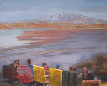
Desert Lounge.jpg - Submitted Version
Available under License Creative Commons Attribution Non-commercial No Derivatives.
Download (5MB) | Preview
Manchester Sq Burnout #2.JPG - Submitted Version
Available under License Creative Commons Attribution Non-commercial No Derivatives.
Download (2MB) | Preview
![[thumbnail of Painting]](http://researcharchive.wintec.ac.nz/5774/3.hassmallThumbnailVersion/Manchester%20Sq%20burnout%201.jpg)
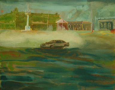
Manchester Sq burnout 1.jpg - Submitted Version
Available under License Creative Commons Attribution Non-commercial No Derivatives.
Download (2MB) | Preview
Miranui Scutching Shed showing Mill Dam and Offroaders in the foreground.JPG - Submitted Version
Available under License Creative Commons Attribution Non-commercial No Derivatives.
Download (2MB) | Preview
![[thumbnail of Painting]](http://researcharchive.wintec.ac.nz/5774/5.hassmallThumbnailVersion/Smoker.jpg)
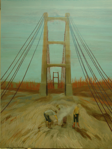
Smoker.jpg - Submitted Version
Available under License Creative Commons Attribution Non-commercial No Derivatives.
Download (2MB) | Preview
![[thumbnail of Painting]](http://researcharchive.wintec.ac.nz/5774/6.hassmallThumbnailVersion/Flood%20Protection%20Cut.jpg)
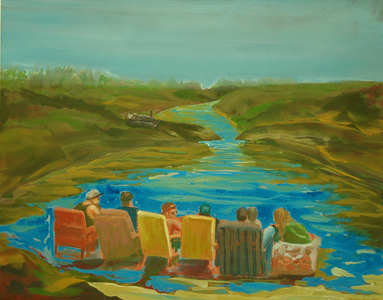
Flood Protection Cut.jpg - Submitted Version
Available under License Creative Commons Attribution Non-commercial No Derivatives.
Download (2MB) | Preview
Five Mile Avenue, Forty Mile Bush.JPG - Submitted Version
Available under License Creative Commons Attribution Non-commercial No Derivatives.
Download (1MB) | Preview
Gorge Ferry (2).JPG - Submitted Version
Available under License Creative Commons Attribution Non-commercial No Derivatives.
Download (2MB) | Preview
Out Late.JPG - Submitted Version
Available under License Creative Commons Attribution Non-commercial No Derivatives.
Download (3MB) | Preview
![[thumbnail of Painting]](http://researcharchive.wintec.ac.nz/5774/10.hassmallThumbnailVersion/Opiki%20%28baptists%27%29%20picnic%20April%202011sml.jpg)
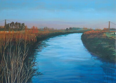
Opiki (baptists') picnic April 2011sml.jpg - Submitted Version
Available under License Creative Commons Attribution Non-commercial No Derivatives.
Download (230kB) | Preview
Exhibition handout.pdf - Supplemental Material
Available under License Creative Commons Attribution Non-commercial No Derivatives.
Download (780kB)
Abstract
The stretch from the Square, down Pioneer Highway, past Jackeytown Road, Karere Lagoon and out to Foxton, measured the centre of my early childhood. As I grew, my area expanded to include Shannon, Feilding, the Whirokino Trestle and river bank, the Pohongina Valley, and up to the Desert Road and Taupo. And, of course, to Wellington.
Between the late 1800s and 1940s, flax milling was a big industry in much of the area around Tiakitahuna. A substantial flax mill was located at the Opiki Bridge. We’d often drive across its creaking boards… it’s still a fascinating place to visit because of the spectre of its towers and the ragged wires that invite climbing.
Flax growing and milling altered the swampy landscape, enflamed tensions between Māori and colonials, encouraged the formation of trade unions, and polluted the Manawatū River.
Visiting Manawatū and Rangitikei now, I like that it’s all shifted and changed to accommodate current needs and amusements. The reminders are still there, but there are carparks, boat ramps, racetracks and ‘light no fires’ signs.
This exhibition comprises a suite of paintings that mingle historical, pastoral, and imaginary situations; it is a tender and playful reflection on a set of unglamorous yet peculiar locations and the identities that link to them.
| Item Type: | Curating an exhibition or other artistic event |
|---|---|
| Uncontrolled Keywords: | Regional landscape painting |
| Subjects: | N Fine Arts > ND Painting |
| Divisions: | Schools > School of Media Arts |
| Depositing User: | Tim Croucher |
| Date Deposited: | 22 Jan 2018 02:27 |
| Last Modified: | 21 Jul 2023 06:35 |
| URI: | http://researcharchive.wintec.ac.nz/id/eprint/5774 |
Available Versions of this Item
- Pioneer Highway; new paintings by Tim Croucher. (deposited 22 Jan 2018 02:27) [Currently Displayed]

